Drafting capacity for survey firms, without adding headcount
You've collected the field data. We turn it into a finished, properly formatted drawing ready for your review and seal. Our principal worked in land surveying in Northern Michigan before starting this firm, so your drawings are drafted by someone who knows what the field data means and what the finished survey has to show.
We're not a surveying firm. We don't collect field data, establish boundaries, or certify survey work; that stays entirely with you as the licensed surveyor. We work with survey firms across Michigan, including Grand Traverse, Leelanau, Antrim, Benzie, and Kalkaska Counties.
What we draft from your data
- Boundary surveys — clean, dimensioned drawings of property lines and corners from your field data
- Property division (split) drawings — parcel splits drafted to the dimensions and configuration you specify
- Mortgage inspections — location drawings formatted for lender and title company requirements
- ALTA/NSPS surveys — drafted to the table A items and formatting standards your client's transaction requires
- Site plans — building placement, setbacks, and site features drawn from your survey
- Topographic surveys — contour lines and spot elevations drafted from your collected elevation data
- Riparian surveys and studies — waters edge, meander lines, transects, and riparian lines run to the thread of the lake
- Stakeout drawings — point numbers, descriptions, and stakeout calls for your crew
- Legal descriptions — written from the drawing for your review, available as an add-on to any survey
From a rough record to a finished drawing
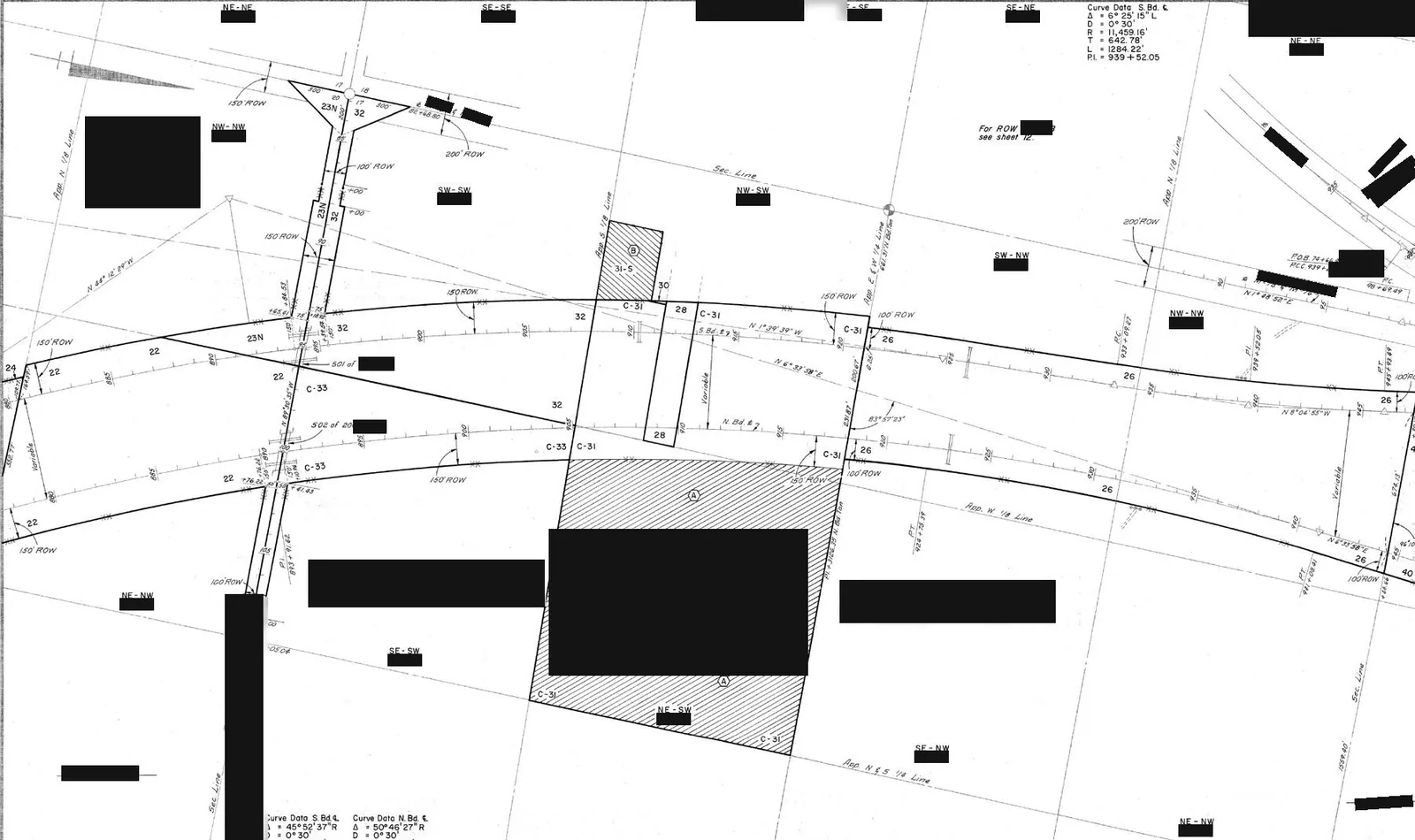
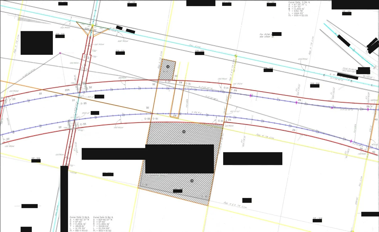
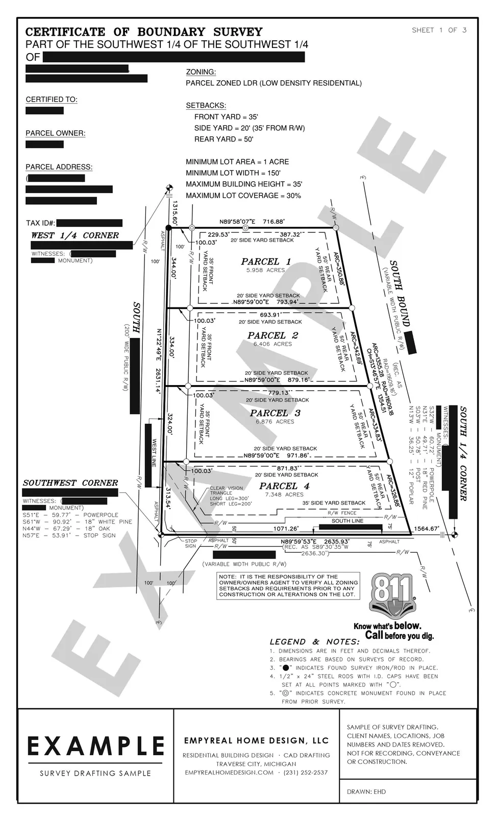
Field data isn't always the whole job. Sometimes the only source for a line is an old record. Here, a decades-old highway right-of-way map was the record for the interstate right-of-way. We rebuilt the alignment from the curve data and stationing on the sheet, checked our linework against the scan, and used it to draft a four-parcel division.
See the survey drafting portfolio below for more finished sheets: ALTA/NSPS surveys, boundary surveys and divisions, site plans, topographic surveys, riparian surveys, and stakeouts.
Turnaround time
You get a linework scrub within 24–48 hours of sending complete field data: your points brought in, cleaned up, and connected, so you can check the linework early. The completed drawing follows within 7 business days.
Complex jobs, such as ALTA/NSPS surveys with multiple Table A items, large parcel divisions, or projects with significant point cloud or LiDAR data, may take longer, and we'll tell you that upfront when we quote. Rush turnaround is available when a closing deadline requires it.
How it works
- Send your data — field notes, raw collector files, sketches, or existing CAD. Include your firm's title block and standards if you want us to use them, or a sample drawing.
- We scope and quote — we review your data, confirm the survey type, and send a written quote. No work starts before you've seen and agreed to the price.
- Linework scrub in 24–48 hours — we return the cleaned-up linework for you to check before the drawing is built out.
- Completed drawing within 7 business days — delivered as a PDF for your review.
- Revisions and final — send a redline and we correct it. The final drawing is delivered ready for your seal and signature.
Our CAD setup, or yours
We have our own complete CAD setup, with plot style, title block, line weights, and layer standards, and we draft to that by default. If your firm has its own title block or standards, send them with your data and we'll draft to yours. If you don't have a title block and want one, we can design one for your firm to use going forward. Either way, you stay the licensed professional of record.
Field codes and description keys
If we haven't worked with your field code system before, the first job may include one-time setup time to build out your description key set, and that will be shown in the quote. Once it's built, it carries forward to every later job that uses the same codes.
What it costs
Every project is quoted in writing before any work starts, based on the survey type and the data you send. You pay only for completed work. When there's nothing to draft, you pay nothing.
Common questions
What file formats do you accept and deliver?
We draft in Carlson Survey and Civil 3D, and we take data from any collector or software — Carlson, Trimble, Leica, LandXML, raw collector files, CSV point files, DWG, DXF, PDF sketches, and hand-drawn field notes scanned to PDF. We deliver the finished drawing as a PDF. The DWG file is available on request at an additional cost; tell us when you send the job and we'll include it in the quote.
What if my field data has errors or gaps?
We flag them before we draft around them. If we find missing shots, conflicting measurements, or data that doesn't close, we'll contact you before proceeding rather than make assumptions. A drawing built on a problem in the field data just passes the problem downstream — we'd rather stop and confirm than deliver something that comes back as a correction.
How do I send my data?
Email works fine for most projects. For large files — dense point clouds, LiDAR datasets — we can arrange a shared folder or file transfer link. We'll confirm the handoff method when we scope your first project.
What if I'm not satisfied with the drawing?
Revisions are part of the process. If a drawing comes back and something isn't right — formatting, linework, dimensions, anything — send us the redline and we'll correct it. The goal is a drawing that's ready for your seal, and we don't consider a project complete until it gets there.
Data security and confidentiality
Survey data contains your clients' parcel information, legal descriptions, and sensitive boundary data. Data you send is used for your project. We don’t share your clients’ information, and any work we show as an example has all client, firm and location details removed. If your firm requires a signed NDA before sending data, we're happy to accommodate that.
Why outsource drafting instead of hiring
Bringing on a full-time drafter only makes sense if you've got steady, year-round volume to justify it. For a lot of survey firms, workload comes in waves — busy season, slow season, the occasional rush job with a tight closing date. Outsourcing drafting gives you flexible capacity without the overhead of another employee, and you only pay for the work that actually comes through the door.
Who this is for
Licensed land surveyors and survey firms who need reliable CAD drafting capacity — whether that's overflow during busy season, coverage so a small firm doesn't need a full-time drafter, or a standing arrangement for recurring volume.